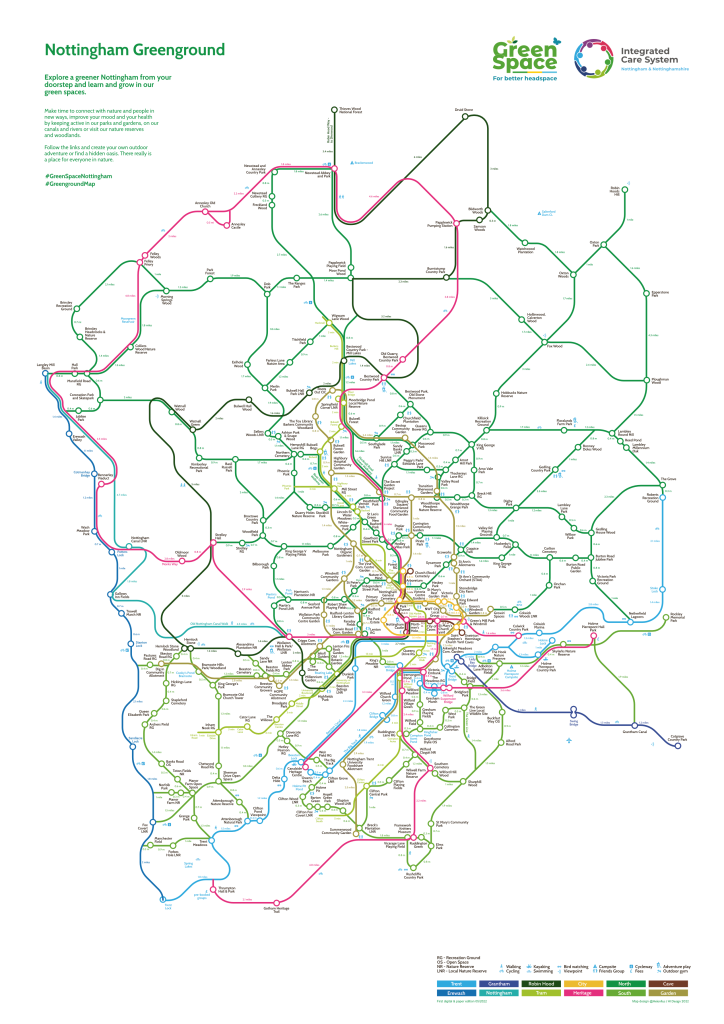
Nottingham Greenground Map
The Nottingham Greenground Map has arrived and copies are available in lots of our green spaces around the city so you can spend the summer exploring!
The map has been created in collaboration with Helen Ilus, an artist living in Tallin who has created Greenground Maps for several cities in the UK, including London, Sheffield and Birmingham. Inspired by the iconic London Tube Map, Helen’s Greenground Maps identify all the different green spaces around the city that you may want to visit.
The locations are joined by themed lines, such as the pink Heritage line that links historic locations such as Wollaton Hall, Newstead Abbey and Green’s Windmill, or the khaki Garden Line that shows the location of all the different community gardens.
Read the green space bulletin and view the FREE digital map or ask for the paper copy >>
The map was commissioned by the Nottingham Community and Voluntary Service.

Sheffield Greenground Map
‘Did you know a whopping 61% of Sheffield is green space? We’re still yet to find another city in the world with a higher percentage than this…
Sheffield actually has more than 800 managed green spaces across 4,000 hectares within the city boundary. With so much on offer, we wanted to create something to help demonstrate how accessible greenspaces are in The Outdoor City and so we’ve commissioned a ‘Greenground Map’.‘
Read the full blog post and download the FREE digital map or find the paper copy in the city >>
The map was commissioned by the The Outdoor City and Sheffield City Council.

Birmingham Greenground Map
‘A City of Nature – Greenground Map
It may surprise you to hear that Birmingham is home to over 600 green spaces – ranging from small playing fields to expansive nature reserves, connected by our unique canal networks, rivers and walkways. Each and every one of these spaces are vital to our wellbeing, acting as spaces for us to play, socialise and make memories. We wanted a way to showcase these areas without relying on the road dominated maps we’re so used to – something that is increasingly important in the face of a changing climate.’
Read the full blog post and download the FREE digital map or request a paper copy >>
The map was commissioned by the Naturally Birmingham: Future Parks Accelerator and Birmingham City Council.

Cambridgeshire and Peterborough Greenground Map
‘The Cambridgeshire and Peterborough GreenGround Map represents the parks and greenspace within the five key urban areas, including Cambridge, Peterborough and Ely City and the Towns of Huntingdon and Wisbech. By drawing on the river, railway and trail themes as key lines, the map clearly shows the accessibility of parks and greenspaces for everyone to enjoy.’
Read the full blog post and download the FREE digital map >>
The map was commissioned by Cambridgeshire and Peterborough Future Parks.
