
Over 400 National Parks connected with Europe’s official long distance walking and cycling routes
Explore Europe in a green way
This new minimalist map aims to connect Europe’s National Parks with official long-distance walking and cycling routes. With 400+ National Parks, 12 official E-paths and 17 EuroVelo routes this map is a useful tool for planning nature adventures across Europe either on foot or on bike. The visually stylized map makes the connections between National Parks easy to see, helps with the planning and serves as an inspiring wall map between the adventures.
Make a one-time contribution
This downloadable map is open to everyone, but if you can, please consider making a one-time contribution between €5-€25. Your contribution is greatly appreciated!
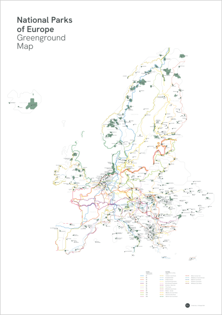
A1 Posters are available at Stanfords map store and every purchase will directly support the independent map-making!
What reviewers are saying about other Greenground maps
“I’ve seen parts of London I’d never have thought to visit otherwise, and I feel like I know the city better than I ever have.”
– TELEGRAPH TRAVEL
“The latest version of the Greenground Map comprehensively collects all the capital’s finest nature spots.”
– TIME OUT LONDON
“At first glance, it looks a lot like a tube map. But this map by graphic designer Helen Ilus is instead intended as an inspiration for walkers and cyclists.. The options for exploring London in a new, greener way are infinite.”
– LONDONIST
