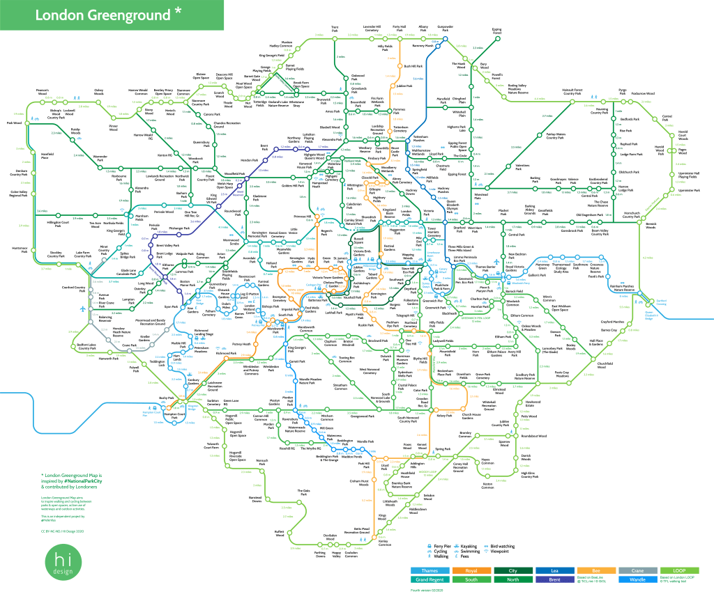
The newest of London Greenground maps has more fluid lines, especially for Thames line that now follows the river more naturally, includes 100 more parks with 400 parks and open spaces total and as a new feature shows the walking distances between parks. I have also began to locate the green ways that are long linear parks usually by the waterway or railway tracks and sketched in some new suggestions for creative walking loops. 🚶♀️♾️
This diametrical map does not show the exact routes, but rather acts as a starting point in planning more precise journeys. The distance line lengths between parks and open spaces vary as the walking routes are not always straightforward and at times can be quite winding. This is why a mile on a map is represented with considerable difference. However I hope the map gives a larger scope for someone planning a green route in Greater London.
In most cases the distances are calculated from park centre to park centre and sometimes, especially with large parks, the walking distance between differs. For example Kensington and Hyde Park are next to each other and could be crossed over in minutes, but walking from centre to centre is a mile long route and takes considerably more time. As no one would be walking only to the edge of the park I thought centre distances would make more sense.
The loops and lines that make up the map are suggestions rather than fixed routes and the main intention of the map is to show London as one connected green network and encourage active movement between parks and along the waterways. Currently not all the London roads are quiet or safe because of traffic, but hopefully this will change soon when more people are becoming interested in active travel. 🚶♀️🚴♂️
For closer exploration see the PDF
100,000+ views/downloads so far!
Would like to support the development of Greenground Map? Your donation will help the map to grow! 🌱

