All my paper maps are currently available at Stanfords Map and Travel Bookshop in London. You can search for Greenground Maps in their store or browse the selection below.
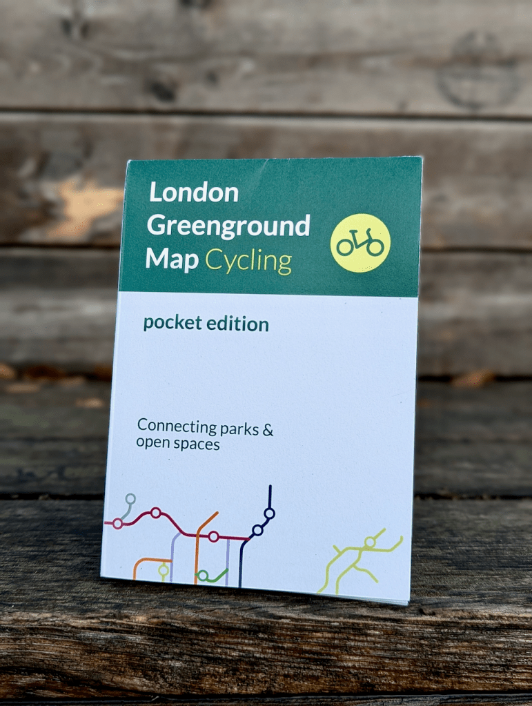
New! London Greenground Map – Cycling (folded map)
A smaller version of the large wall map, the London Greenground Map – Cycling Edition connects the National Cycle Network, Cycleways, and the extended cycle network to green spaces and waterways. This map aims to make both commuting and leisure cycling greener and more enjoyable, while encouraging exploration on two wheels for cyclists of all abilities. Whether you prefer a mostly traffic-free river path, a well-marked cycleway, or a more challenging route, this handy map will help you discover over six hundred green spaces across Greater London.
This map is printed on 100% FSC certified recycled paper, reducing environmental impact.
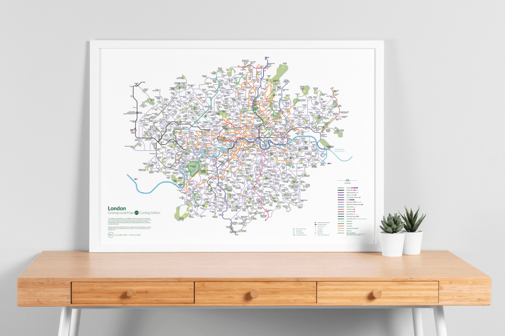
London Greenground Map – Cycling Edition, 2nd edition
The London Greenground Map – Cycling Edition is the first schematic city-wide map connecting the National Cycle Network, Cycleways, and the extended cycle network to green spaces and waterways. This map aims to make both commuting and leisure cycling greener and more enjoyable while encouraging exploration on two wheels for cyclists of all abilities. Whether you prefer a mostly traffic-free river path, a well-marked cycleway, or a more challenging route, this map will help you discover over a six hundred green spaces across the city.
Read more >>

Greenground Map of the British Isles and Ireland
This extensive view of the British Isles and Ireland helps you get an overview of the region’s national parks and natural landscapes, connecting them to the main national trails and long-distance paths. Inspired by tube maps, the schematic design invites you to see the area through its natural features—highlighting walking paths instead of roads, and nature sites instead of settlements.
Meant for inspiration and planning rather than on-the-go navigation, this map brings together information from many sources to create a green network for everyone to explore.
Read more >>
London Greenground Map – 3rd edition
The third London Greenground Map is the largest greenground map to date – connecting 1,200 green spaces with 20 inspirational lines for exploring the London-wide network of parks, rivers, nature reserves, woods and wetlands. Covering all London boroughs every neighbourhood will find nature on their doorstep.
Unlike the first two maps, which focused on long-distance outdoor activities, the third map invites you to slow down, be mindful of your surroundings, and reconnect with nature. It highlights places across Greater London where you can pause, breathe fresh air, and experience quieter green spaces. While the cleanest air and largest areas of greenery are found on the outskirts, you can find hidden natural gems throughout the city.
Read more >>

London Greenground Map – 2nd edition
The second paper edition of the London Greenground Map is a bigger and expanded version of the much loved and shared first map. Double the size the new map connects twice as many parks and open spaces with 18 green & blue lines and an art line! The tube style map for walking & cycling now also links to North Downs Way, includes city farms, Brompton docks and suggests camping sites to get out to the urban nature and beyond.
The eco-friendly A2 map is printed on the FSC® certified recycled 120g Nautilus Classic paper with inks based on natural resins and oils.
Read more >>

London Bookground Map
London Bookground Map is the first side step from the Greenground Map project to a new path, connecting libraries across London into a large creative library network. 350 mostly public, specialist and some member libraries are linked together with 12 thematic lines based on historic writers with connections to London. Walking distances, closest bus stops and bike parking on the map make planning your visits easy and the activity icons in the index help to find what’s happening in the library.
The eco-friendly A2 map is printed on the FSC® certified recycled 120g Nautilus Classic paper with inks based on natural resins and oils.
Read more >>

Bristol Greenground Map
Innovative first edition small pocket map connecting 250 parks & open spaces with 10 green lines to walk and cycle in Bristol.
The map is printed digitally on the FSC® certified 170g G-Print paper in small quantities and according to demand.
Read more >>

Edinburgh Greenground Map
Innovative first edition small pocket map connecting 220 parks & open spaces with 9 green lines to walk and cycle in Edinburgh.
The map is printed digitally on the FSC® certified 170g G-Print paper in small quantities and according to demand.

London Greenground Map
Innovative tube style walking map connecting 380 parks and open spaces with 12 inspiring green lines.
The map is printed digitally on the FSC® certified 170g G-Print paper in small quantities and according to demand.
