The first paper edition of #GreengroundMap came out last week (yay!) and I have been thinking how the Greenground idea could work in reality. The map is inspired by the London underground system, but the core idea is for people to walk and cycle between parks and green spaces. Obviously the Greenground is not as defined as the transport system, where the tube takes people from station the station. So how would walkers and cyclists navigate from park to park in a simple and straightforward way using visual clues like they do in the underground?
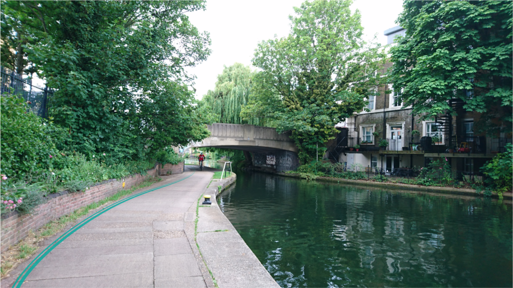
The simplest solution would be to use painted lines on the pavement in public spaces. As the cities grow more complicated, the coloured footpath lines could build a designated grid for the walkers and cyclists through quieter natural environments, away from the busy roadsides and traffic. This could work well along the waterways, which by nature are simple to navigate. The lines wouldn’t divide the path like traffic lines do, but run alongside as a navigation tool, making the turns and twists at detours.

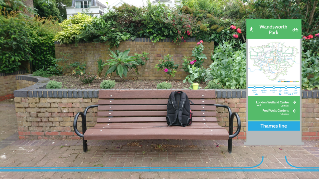
The parks and open spaces on the line would be the open green ‘stations’ where to rest briefly or spend time in nature and enjoy outdoor activities. Parks could have some designated seating areas and signage for the ‘Greenground’ commuters and even facilities such as water fills and bicycle racks. The downside could be the overcrowded lines in certain times and some of these ‘park stations’ could face overuse. However, if to guide the Greenground commuters to wider roads, the rest of park grounds wouldn’t suffer as much.
The pavement lines could work in paved city environment, but not all London (thankfully) is paved. There are still plenty of tracks and paths for walkers and cyclists to explore in more natural surroundings. The walking paths such as Capital Ring and London Loop mostly go through natural environments and are intended for urban hikers. The Greenground is not a competition to these paths and does not replace them. It’s a visual navigation system to enable people to switch from transport systems to active travel more easily.

Perhaps this physical marking is not so much needed in the digital era, where everyone has a personal navigation device. The map could also remain digital and act as a reference rather than propose a physical way-finding system. With no painted lines the Greenground navigation could be more intuitive and personal. With only existing virtually, the lines can be easily adjusted, added and changed if one area starts to get too much traffic. Especially small parks and narrow paths may feel the pressure more, if suddenly too many people passes through.
It’s wonderful the first Greenground map has been received so well, but is it just a quirky idea or could it be a real life navigation system?
