
The first paper edition of the London Greenground Map came out a year ago and included 380 parks & open spaces and 12 inspiring green lines for walking and cycling between parks. First map also included viewpoints, ferry piers and suggestions for outdoor activities such as kayaking, outdoor swimming and bird watching. This small pocket map got lot of media interest and people loved the concept – 1000 maps sold out by the beginning of this year.
The second edition of the London Greenground Map aims to keep the spirit of the first map, but expands the concept wider, now including twice as many parks in London to give more scope to explore. I’ve also included six more green & blue lines and an art line. The upgraded map is twice the size of the original map and printed on the recycled paper with sustainable inks, yet comes with the same price tag as the original.
Second edition includes several new interesting lines. Additionally to the official TFL and Ramblers’ LOOP line that appeared as an outer border on the first map, the new edition of the Greenground Map now also includes the highly requested Capital line, connecting the parks and open spaces of this popular walking path. And the LOOP is no longer the outer border – the map now breaks through the London Orbital, creating links with the countryside beyond.
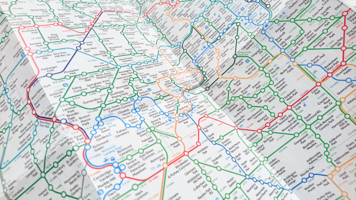
In south the map now includes the Surrey Hills Area of Outstanding Natural Beauty and a section of North Downs Way from Box Hill to Sevenoaks. The Thames Downs line connects the Thames to the North Downs Way. The detailed directions can be viewed here. On the east the the two lines are connected by the Darent Valley line that runs from Dartford to Sevenoaks.
The Royal Line now extends up to Windsor taking in the famous Windsor Great Park and The Long Walk as well as few historic green spaces along the way such as Runnymede. Additionally to Darent the new river lines now also include Ravensbourne in South-East and Roding in North-East, both connecting Thames with LOOP line.
The Line – London’s first dedicated public art walk is now on the map as Art line, passing several parks and green spaces on the way. Starting from Queen Elizabeth Park it goes through the Three Mills Green and Cody Dock before crossing the Thames to Greenwich Peninsula. More detailed map with the artworks can be seen here.
Brompton Dock icons now point where to hire a Brompton bike for cycling between green spaces inside London or even for outdoor adventures further out in the countryside. The more detailed map with exact locations is here.
Second edition also includes city farms and this TimeOut article highlights some. I’ve also added icons for selected campsites around London for getting out to nature. Couple of outdoor bouldering sites make another interesting day out.
With twice as many green spaces, seven new lines and more outdoor activities to discover I hope the second map will be an inspiration for both existing and new London Greenground explorers 🤞

The second paper edition of the Greenground Map is now available in my store for £10 (postage included).
